Roof & Exterior Inspections
High-resolution aerial documentation for residential and commercial roofs, siding, exterior components and hard-to-reach areas.
 PRECISIONAERIAL INSPECTION
FAA PART 107 CERTIFIED • INSURED • SERVING MAINE
Professional aerial inspection, thermal imaging and visual documentation for Maine homeowners, contractors, commercial properties and industrial facilities.

Inspection intelligence
PAI uses professional aerial imaging and thermal capability to document conditions in places that are difficult, costly or risky to view from the ground.
High-resolution aerial documentation for residential and commercial roofs, siding, exterior components and hard-to-reach areas.
Radiometric thermal imagery used to identify temperature patterns that may warrant closer evaluation when conditions support useful thermal data.
Aerial visual and thermal documentation for mills, facilities, equipment, structures and other complex assets.
Detailed aerial documentation for difficult-access infrastructure, condition records and project planning support.
Repeatable aerial photography and organized records that make site progress easier to review, compare and communicate.
Photogrammetry, visual site models and high-resolution aerial overviews for documentation and planning—not licensed boundary surveying.
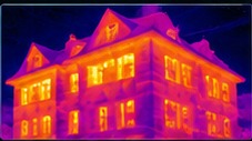
Thermal capability
Thermal imaging adds information standard photography cannot show—but a temperature pattern is evidence to investigate, not a diagnosis by itself.
Building envelopes & roofs
Screen for meaningful temperature differences under suitable environmental conditions.
Electrical & mechanical assets
Document visible thermal anomalies for qualified follow-up where appropriate.
Clear reporting boundaries
Reports distinguish observed thermal indications from verified conditions and conclusions requiring other professionals.
Aerial capabilities
Visual, thermal, mapping and documentation tools can be matched to the question the project needs answered.
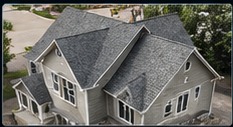
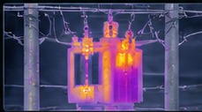
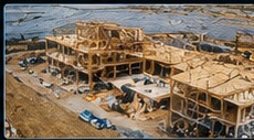
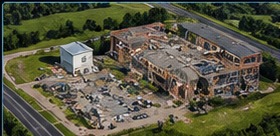

Capability imagery is used to illustrate the types of data and views available; project-specific findings are reported only from the actual inspection performed.
Experience matters
Owner David Sivret brings 24 years of roofing experience and 15 years running a construction business to the inspection process. The aircraft provides access and perspective; experience provides context.
“The drone provides access and perspective. Experience provides context.”
Deliverables
Depending on project scope, deliverables can include organized visual records, thermal imagery, annotations, location context, video, progress comparisons and 3D visualization.
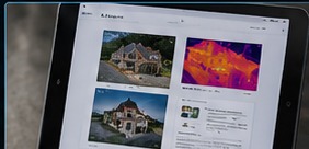
Clear visual documentation of the areas that matter.
Useful labels and context instead of a folder full of unexplained photos.
Radiometric imagery when thermal conditions and project scope support it.
Customer-ready documentation built around the inspection objective.
How it works
We start with what you need to see, document or understand.
Airspace, weather, site conditions, access and the inspection objective shape the flight plan.
Visual, thermal or mapping data is collected methodically for the project.
You receive organized documentation designed to support the next decision.

Precision Aerial Inspection provides aerial inspection and documentation support. Services do not replace licensed engineering, electrical, code, environmental or land-survey evaluations where those qualifications are required. Thermal imagery shows surface-temperature patterns and does not by itself prove moisture, leaks, mold, electrical failure or structural defects. Flights remain subject to FAA rules, airspace authorization, weather, site access, privacy and safe operating conditions.
Now accepting projects
Residential, commercial and industrial aerial inspection projects throughout Maine.
DAVID SIVRET OWNER
(207) 904-9785 David@precisionaerialinspection.net facebook.com/PrecisionAerialInspection Based in Calais • Serving Maine